
kapusons-ui-map
v1.3.10
Published
Kapusons implementation of interactive map through GeoJson data
Downloads
59


Readme
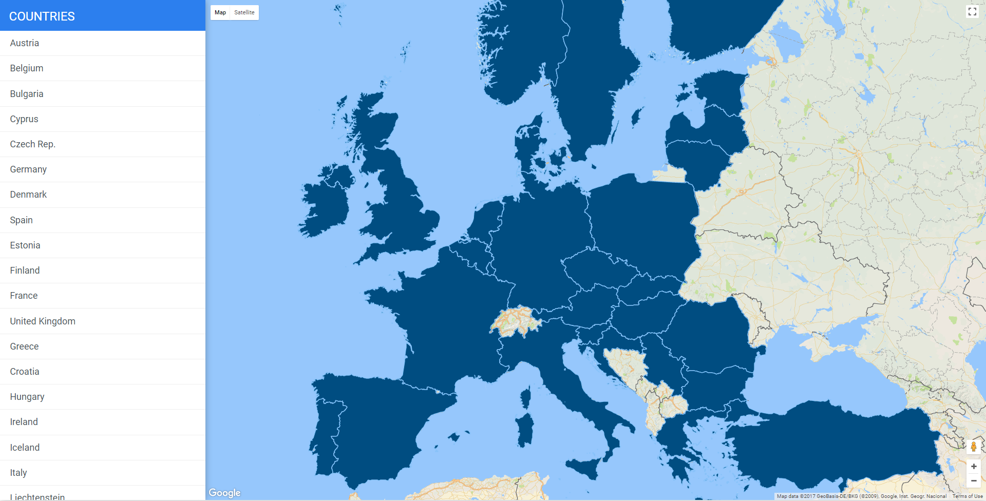
kapusons-ui-map is a Kapusons implementation of interactive maps through GeoJson data. It uses Google Maps API. It allows you to easily render polygons of all the world's states over a google map.
Features
Complete navigation flow
kapusons-ui-map consists in a mini-site with a common navigation flow:
- A general map, with the states you've choosen, as an index page
- A second level shows markers associated with the selected country with few informations
- A third level goes inside the marker info and displays a longer description (enabled for italian regions, for italy and afghanistan as example)
GeoJson data
kapusons-ui-map provides two GeoJson libraries with polygons coordinates for:
- Italian regions
- All the world's states until 2015.
Fully configurable jQuery plugin
kapusons-ui-map requires jQuery as it's released as a jQuery plugin.
Installation
Setup development environment
git clone [email protected]:KapusonsSRL/kapusons-ui-map.git
npm install
gulp serve
As a npm package
npm install kapusons-ui-map --saveUsage
You will need to include:
- Google maps API with proper API key
- jQuery library
- The JavaScript file
kapusons-ui-map.js(or its minified versionkapusons-ui-map.min.js) - The css file
kapusons-ui-map.css(or its minified versionkapusons-ui-map.min.css)
Once that is done you'll only need a dom element in your html to initialize the jQuery plugin:
<div id="map-wrapper"></div>and call kapusonsUiMap plugin inside a $(document).ready function:
$('#map-wrapper').kapusonsUiMap()Configuration
A more complex initialization with all options set could look like this:
$('#map-wrapper').kapusonsUiMap({
  dataSource: "json/world.subset.json",
  l10n: 'en',
  mapTitle: 'Regions',
  showLeftColumn: true,
  showRegionTooltip: true,
  showRegionDetail: true,
  map: {
    center: {
      lat: 38.513456,
      lng: 44.523900
    },
    zoom: 5,
    scrollwheel: false,
    gestureHandling: 'cooperative',
      mapTypeControlOptions: {
        style: google.maps.MapTypeControlStyle.DEFAULT
    },
    styles: [
        {
          featureType: "all",
          elementType: "labels",
          stylers: [
            {
              visibility: "off"
            }
          ]
        }
    ]
  },
  features:{
    fillColor: "#3367D6",
    fillColorSelected: "#4285F4",
    strokeWeight: 1.5,
    strokeColor: '#96C7FC',
    fillOpacity: 1
  },
  regionOnClick: null,
  onMapLoaded: null
})
Options
dataSource: defines which json will populate your map; kapusons-ui-map provides two GeoJson libraries (Italian regions and all the world's states until 2015). See how to generate a custom GeoJson library starting from this two.l10n: defines the localization for your mapmapTitle: a string title for your mapshowLeftColumn: displaying or not the left column navigation menushowRegionTooltip: displaying or not the tooltip on state/polygon hover. The tooltip has a class that corresponds to the hovered region name (e.g. .Egypt, .Italy etc...)showRegionDescription: displaying or not the third level info of a selected state/regionmap: MapOptions object specification: Google Maps JavaScript API V3 Referencecenterlatlng
zoomscrollwheelgestureHandlingmapTypeControlOptionsstylesfeatureTypeelementTypestylersvisibility
features: defines the polygon stylesfillColorfillColorSelectedstrokeWeightstrokeColorfillOpacity
regionOnClick: defines a custom handler for click event on a state/polygon; this function ovverrides the default behavioronMapLoaded: the callback fired when the map is idle
How to generate a custom GeoJson library as data source
You can easily create your GeoJson data source starting from the two GeoJson libraries provided by kapousns-ui-map. As you probably want to display a custom set of polygons/states, you'll find a usefull gulp task for this purpose. As example:
gulp json:extract --regions "it,fr,gb" --featureProperty ISO_A2 --searchIn world- In the
--regionsparameter you can define a list of states/polygon you want to include in your map in the form of a comma separated string. Each value must match one of those supported standard code (ISO 3166 and others):SOV_A3,ADMIN,ADM0_A3,GEOUNIT,GU_A3,SUBUNIT,SU_A3,name,NAME_LONG,BRK_A3,BRK_NAME,BRK_GROUP,ABBREV,POSTAL,FIPS_10_,ISO_A2,ISO_A3,ISO_N3,UN_A3,WB_A2,WB_A3,ADM0_A3_IS,ADM0_A3_US - You'll define the selected standard code in the
--featurePropertyparameter, as a comparison value - the
--searchInparameter defines in which data source you'll search the specified regions (availables data source are world and italy)
This task generates a (italy/world).subset-json file in the src/json folder.
Once that is done, you can minify your new GeoJson file by running this task:
gulp json:minify --filename "your-brand-new.json"By running the gulp serve task all the json file in the src folder will be copied into the dist/json folder.
Localization
Kapusons-ui-map provides a minimal support for l10n:
- add a LOCALE.js file with proper translations in the src/js/l10n folder (use the it.js file as a reference)
- add the l10n option in the plugin configuration:
$('#map-wrapper').kapusonsUiMap({ l10n: 'it' })
Contributing
Once you've made your commits:
- Fork kapusons-ui-map
- Create a topic branch -
git checkout -b my_branch - Push to your branch -
git push origin my_branch - Create a Pull Request from your branch
- That's it!
License
MIT (http://www.opensource.org/licenses/mit-license.php)