npm package discovery and stats viewer.

Discover Tips

  • General search

    [free text search, go nuts!]

  • Package details

    pkg:[package-name]

  • User packages

    @[username]

Sponsor

Optimize Toolset

I’ve always been into building performant and accessible sites, but lately I’ve been taking it extremely seriously. So much so that I’ve been building a tool to help me optimize and monitor the sites that I build to make sure that I’m making an attempt to offer the best experience to those who visit them. If you’re into performant, accessible and SEO friendly sites, you might like it too! You can check it out at Optimize Toolset.

About

Hi, 👋, I’m Ryan Hefner  and I built this site for me, and you! The goal of this site was to provide an easy way for me to check the stats on my npm packages, both for prioritizing issues and updates, and to give me a little kick in the pants to keep up on stuff.

As I was building it, I realized that I was actually using the tool to build the tool, and figured I might as well put this out there and hopefully others will find it to be a fast and useful way to search and browse npm packages as I have.

If you’re interested in other things I’m working on, follow me on Twitter or check out the open source projects I’ve been publishing on GitHub.

I am also working on a Twitter bot for this site to tweet the most popular, newest, random packages from npm. Please follow that account now and it will start sending out packages soon–ish.

Open Software & Tools

This site wouldn’t be possible without the immense generosity and tireless efforts from the people who make contributions to the world and share their work via open source initiatives. Thank you 🙏

© 2024 – Pkg Stats / Ryan Hefner

echarts-united-kingdom-js

v0.0.1

Published

Packages all js based geojson related to United Kingdom for echarts

Downloads

35

Readme

Introduction

Digital UK maps are made in compressed geojson format specifically for echarts.
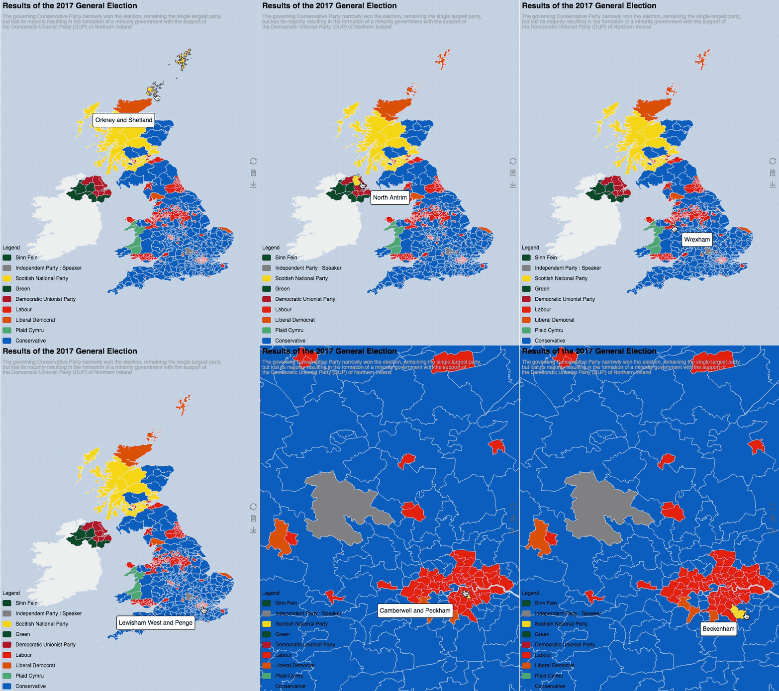
demo

Features

Comparing with standard geojson files, echarts could do lossless compression. Take Westminster map as an example, the un-compressed size is as big as 188MB and the compressed file is of 9.9MB.

Gallery

  1. the Results of 2017 General Election

Content

| echarts reference | origin | | ------------- |:-------------:| | UK_electoral_2016 | Westminster Parliamentary Constituencies December 2016 Full Clipped Boundaries in the UK (reference) |

Credit

The digital boundaries and reference maps was derived from Office of National Statistics.

Under the terms of the Open Government Licence and UK Government Licensing Framework (launched 30 September 2010), if you wish to use or re-use ONS material, whether commercially or privately, you may do so freely without a specific application for a licence, subject to the conditions of the Open Government Licence and the Framework. If you are reproducing ONS content you must include a source accreditation to ONS.

License

Contains National Statistics data © Crown copyright and database right [2018]

Contains OS data © Crown copyright and database right [2018]

And any further sub-licenses MUST retain this attribution. For more legal terms, please visit Office for National Statistics on Licences