@linkdesign/gis
v0.2.1
Published
@linkdesign/gis 组件库,支持在线、离线地图,基于高德amap、leaflet等封装了很多通用的 gis 组件,统一对行业线和对外输出
Downloads
33
Readme
@linkdesign/gis
GIS 组件库
基于高德地图,react组件化了一些基础覆盖物类,内置/封装了一些常用GIS工具函数、高德api以及功能组件; 整合了Leafletjs,支持离线地图;

安装
npm install @linkdesign/gis --save使用
首先在应用的入口文件(entry)引入样式文件:
// In your entry
// 内部依赖 @alifd/next,但打包编译后的样式文件不包含 @alifd/next 的样式(避免样式覆盖导致的诸多问题)
// 如果没有引入,需要另外引入: import '@alifd/next/index.css';
import '@linkdesign/gis/lib/index.less';
使用组件:
import { Map, Marker, Utils } from '@linkdesign/gis';

const { turf, gcoord } = Utils;
能力一览
基础组件
- [x] 在线地图、离线地图
- [x] 点、线、面
- [x] 点标记、圆点
- [x] 圆、矩形、多边形
- [x] 图层
- [x] TileLayer
- [x] GeoJSON
- [x] esri
- [x] TiledMapLayer
- [x] DynamicMapLayer
- [x] AuthMapLayer
- [x] 气泡、信息窗
- [x] 控件:比例尺、旋转缩放
- [x] 坐标系转换
- [x] 拖拽选址
- [x] 位置预览
- [x] 覆盖物编辑器
- [x] json编辑器
- [x] GIS计算函数库 turf(中心点、bounds、点线面关系判断等)
- [x] 坐标转换工具 gcoord
- [ ] ......
业务组件
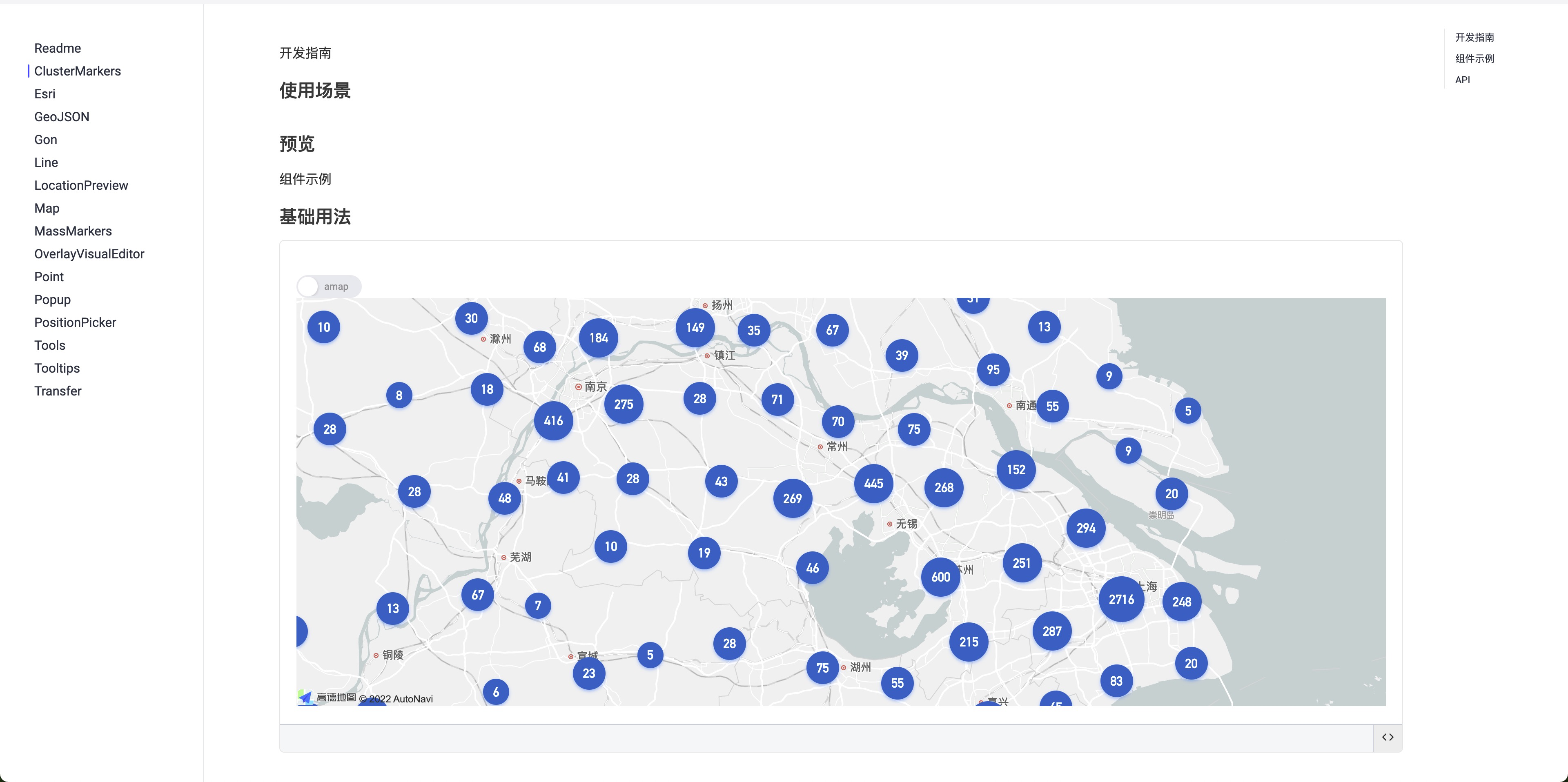
- [x] 点聚合
- [x] 海量点
- [ ] ......
DEMO
!!! demo 中使用的 key 都是测试专用,随时可能失效,切勿在线上环境中使用 !!!
!!! demo 中使用的 key 都是测试专用,随时可能失效,切勿在线上环境中使用 !!!
!!! demo 中使用的 key 都是测试专用,随时可能失效,切勿在线上环境中使用 !!!
Map
import { config, Map } from '@linkdesign/gis';

config.key = 'e51afcf01df9d306ad46e7614964ce3e';

const App = () => {
  return (
    <Map
      onComplete={(map) => {
      window.map = map;
      }}
      onClick={(a, b) => {
      console.log(a, b);
      }}
      onMoveEnd={(a, b) => {
      console.log(a, b);
      }}
      onZoomEnd={(a, b) => {
      console.log(a, b);
      }}
    />
  );
}

ReactDOM.render(<App />);
点、线、面
import React, { useEffect, useRef } from 'react';
import { Map, config, Utils, Marker, Polygon, Circle, Rectangle } from '@linkdesign/gis';

const { gcoord, turf } = Utils;

const PATH = [[
  [116.472958, 39.995534],
  [116.472161, 39.994808],
  [116.471294, 39.995364],
  [116.47126, 39.995384],
  [116.471239, 39.995388],
  [116.471218, 39.995381],
  [116.471184, 39.995355],
  [116.470344, 39.994622],
  [116.469502, 39.993967],
  [116.469193, 39.993716],
  [116.469032, 39.993863],
  [116.468815, 39.994108],
  [116.468625, 39.994355],
  [116.468471, 39.99466],
  [116.468421, 39.994811],
  [116.468366, 39.995156],
  [116.468306, 39.996157],
  [116.468308, 39.996557],
  [116.468483, 39.996884],
  [116.468834, 39.997188],
  [116.469481, 39.997764],
  [116.470511, 39.998708],
  [116.471404, 39.999517],
  [116.471553, 39.999568],
  [116.471713, 39.999563],
  [116.471929, 39.999463],
  [116.473228, 39.998584],
  [116.474008, 39.998046],
  [116.474541, 39.997674],
  [116.474541, 39.997576],
  [116.474604, 39.997049],
  [116.47457, 39.996944],
  [116.474103, 39.99657],
  [116.473535, 39.996057],
  [116.472958, 39.995534]
]];

const App = () => {
  return (
    <div style={{ height: 500 }}>
      <Map
        center={[116.471361, 39.996256]}
        zoom={16}
        mapStyle="amap://styles/whitesmoke"
        onComplete={(map) => {
          window.map = map;
        }}
      >
        <Marker
          position={[116.471361, 39.996256]}
          onAdd={(o, e) => {
            console.log('onAdd', o, e);
          }}
          onClick={(o, e) => {
            console.log('onClick', o, e);
          }}
          onMouseOver={(o, e) => {
            console.log('onMouseOver', o, e);
          }}
          onMouseOut={(o, e) => {
            console.log('onMouseOut', o, e);
          }}
        />

        <Polyline
          tooltip={{
            direction: 'top',
            content: '123',
            offset: [0, -10],
          }}
          path={[
            [116.472958, 39.995534],
            [116.468308, 39.996557],
          ]}
          strokeColor="#f00"
          strokeWeight="10"
          extData={{ text: 222 }}
          onAdd={(o, e) => {
            console.log('onAdd', o, e);
          }}
        />

        <Polygon path={PATH} />

        <Circle
          center={[116.471361, 39.996256]}
          radius={50}
          fillColor="#409EFF"
          strokeColor="#000A58"
          fillOpacity={0.5}
        />

        <Rectangle
          bounds={[
            [116.471404, 39.999517],
            [116.474008, 39.998046],
          ]}
          fillColor="#409EFF"
          strokeColor="#000A58"
          fillOpacity={0.5}
        />
      </Map>
	  </div>
  );
}

ReactDOM.render(<App />);
意见或建议
如果您有任何问题或建议,欢迎在 issues 中反馈
对组件库的建设有任何想法或建议,请联系:
